Getting Started
Order the Book
Book Resources
- Computer Codes
- Microwave Sensors
- Images
- Images for Problem 15.10
- Other Computer Codes
- Errata
- Book Reviews
About the Book
Principal Authors:
Fawwaz T. Ulaby
David G. Long,
Contributing Authors:
William Blackwell
Charles Elachi
Adrian Fung
Chris Ruf
Kamal Sarabandi
Jakob van Zyl
Howard Zebker
Language: English
ISBN: 978-0-472-11935-6
Satellite and Airborne Microwave Sensors
(some of the slides are courtesy of Mr. Tom vanDeak of NASA)-
AirMOSS
NASA P-band Airborne SAR (modified UAVSAR)
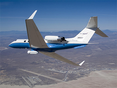
Start date: June 2012
Altitude: 12.5 km
Polarization: H, V
Frequency: 430 MHz
Bandwidth: 20 MHz
Pulse width: 40 μsec
Pulse repetition frequency: 1200 Hz
Transmit power: 2 kW [peak] / 96 W [average]
Chirp rate: 0.5 MHz/μsec
Transmit duty cycle: 4.8%
-
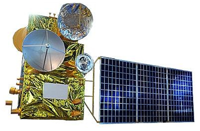
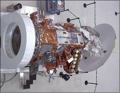
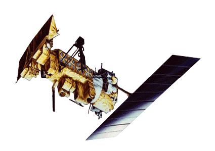
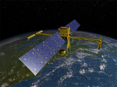
ALOS-1 PALSAR
JAXA Advanced Land Observing Satellite-1: Phased Array L-band Synthetic Aperture Radar
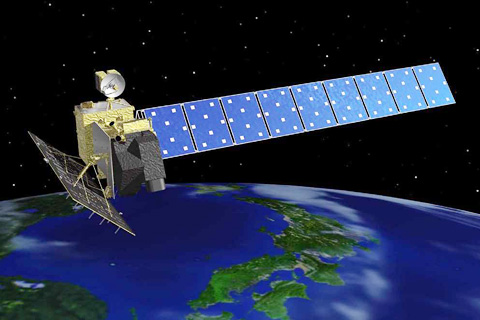
Launch: January 2006
Orbit: Polar orbit at 691 km and 98.16° inclination with 46 day repeat
Polarization: single: HH or VV, dual: HH+HV or VV+VH, or polarimetric depending on the mode.
Frequency: 1270 MHz
Bandwidth: 14 or 28 MHz
Pulse width: 27 or 16 μsec
Pulse repetition frequency: 1500 to 2500 Hz
Transmit power: 2 kW [peak]
Transmit duty cycle: 12 min/orbit
-
ALOS-2 PALSAR-2
JAXA Advanced Land Observing Satellite-2: Phased Array L-band Synthetic Aperture Radar-2
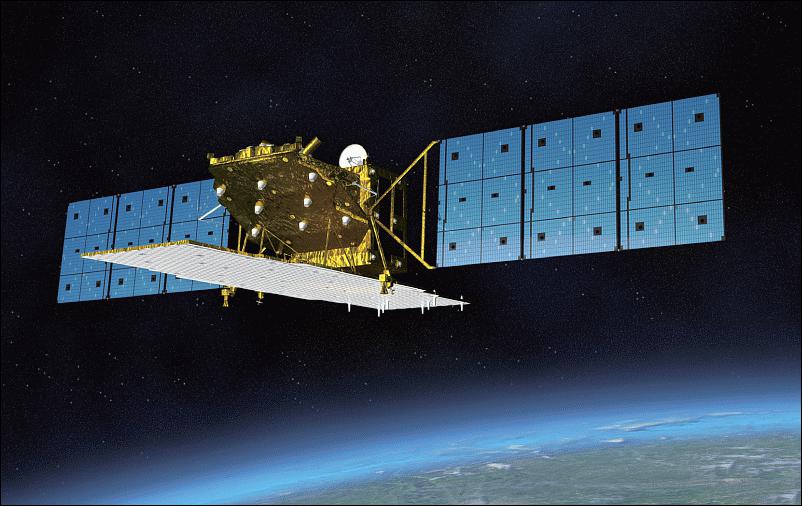
Launch: May 2014
Orbit: Polar orbit at 628 km 97.9° inclination with 14 day repeat
Polarization: single: HH or VV, dual: HH+HV or VV+VH, or polarimetric depending on the mode.
Frequency: 1236.5 / 1257.5 / 1278.5 MHz (selectable)
Bandwidth: 14 / 28 / 42 / 84 MHz
Pulse repetition frequency: 1500 to 3000 Hz
Transmit power: 3.3 or 6.1 kW [peak]
Transmit duty cycle: 27 min/orbit
-
Altimeter and Scatterometer on HY2A
Dual-band (C- and Ku-) radar altimeter and Ku-band scatterometer on CAST (China) HY-2A Earth Observation Mission
Launch: August 2011
Orbit: Polar orbit at 963 km and 99.3° inclination with 14 day repeat
Polarization: Linear VV [altimeter]; Linear HH and VV [scatterometer]
Frequency: 5.25 GHz, 13.58 GHz [altimeter]; 13.2555 GHz [scatterometer]
Bandwidth: 160 MHz (C-band), 20 MHz, 80 MHz, 320 MHz (Ku-band) [altimeter]; 3–6 MHz [scatterometer]
Pulse width: 102 μsec [altimeter]; 650–1200 μsec [scatterometer]
Pulse repetition frequency: 1000–4000 Hz [altimeter]; 100–200 Hz [scatterometer]
Transmit power: 20 W (peak) / 8.2 W (average) [altimeter]; 120 W (peak) / 28.2 W (average) [scatterometer]
Chirp rate: 1.56 MHz/μsec, 0.2 MHz/μsec, 0.78 MHz/μsec, 3.12 MHz/μsec [altimeter]; 0.005 MHz/μsec [scatterometer]
Transmit duty cycle: 40.96% [altimeter]; 24% [scatterometer]
HY-2 is a second generation ocean observation/monitoring satellite series approved by CNSA (China National Space Administration) Beijing in Feb. 2007. The HY-2A mission represents a follow-up of the HY-1A and HY-1B missions. The overall objective of HY-2 is the measurement of ocean dynamic and environmental parameters in the microwave region (i.e., all weather observations). The requirements call also for the collection of data on marine wind setup (wind vector), marine surface height, and SST (Sea Surface Temperature), along with aero-marine forecasts for the prevention and relief of disaster.
-
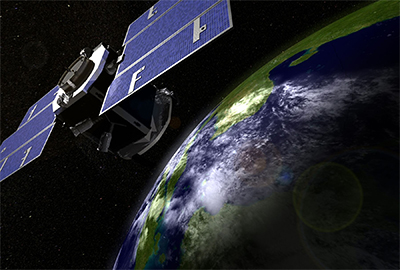
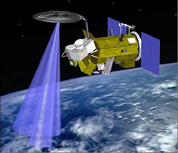
AMR
Advanced Microwave Radiometer on NASA/CNES Surface Water and Ocean Topography (SWOT) mission
Projected launch: 2020
Orbit: Orbit at 970 km and 78° inclination with 22 day repeat
Frequency: 18.7 GHz, 23.8 GHz, and 34 GHz
SWOT satellite mission and its wide-swath altimetry technology are a means of completely covering the world's oceans and freshwater bodies with repeated elevation measurements. Corrects radar data for signal delays caused by tropospheric water vapor.
-
AMSU
Advanced Microwave Sounding Unit on NASA's AQUA
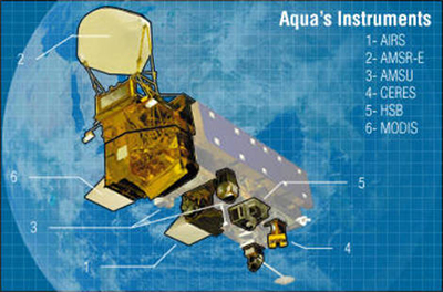
Launch: 4 May 2002
Orbit: Sun-synchronous at 705 km, ascending node crossing at 1330 with a 16 day repeat cycle
Frequency: 23.8 GHz, 31.4 GHz, 50.3 GHz, 53 GHz (2),55 GHz (3), 57.3 GHz GHz (5), 89 GHz
AMSU Provides vertical temperature profiles up to 50 km; “Window” channels correct temperature soundings for surface emissivity, atmospheric liquid water, and total precipitable water.
-
Aquarius/SAC-D
Integrated L-band radiometers and scatterometer on NASA/CONAE Aquarius/SAC-D
Launch: June 2011
Orbit: Polar orbit at 657 km and 98° inclination with 7 day repeat
Polarization: Linear H and V
Frequency: 1.42 GHz
Measures the microwave brightness temperatures of the ocean surface, which are sensitive to salinity and surface roughness. Radiometer measurements are complemented by the scatterometer system measuring ocean roughness.
-
Aquarius/SAC-D Scatterometer
NASA Mission Flying on Argentina SAC-D Satellite
Launch: June 2011
Orbit: Polar orbit at 657 km and 98° inclination with 7 day repeat
Polarization: Linear H and V
Frequency: 1.26 GHz
Bandwidth: 4 MHz
Pulse width: 1000 μsec
Pulse repetition frequency: 100 Hz
Transmit power: 200 W [peak] / 20 W [average]
Chirp rate: 0.004 MHz/μsec
Transmit duty cycle: 10%
Three beam scatterometer system which complements radiometer measurements of ocean salinity.
-
ASAR
Advanced SAR on ESA Environmental Satellite (EnviSat)
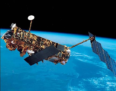
Launch: 1 March 2005
Orbit: Near-circular sun-synchronous orbit at 800 km and 98.55° inclination with a 35 day repeat cycle
Polarization: HH, VV, VV/HH, HV/HH, VH/VV
Frequency: 5.331 GHz
Pulse repetition frequency: 1.65–2.1 kHz
Transmit power: 647–1395 W [mode-dependent]
Transmit duty cycle: 43%
The main objective of ASAR is to provide information on: ocean waves, sea ice extent and motion, snow and ice extent, surface topography, land surface properties, Earth's biomass (especially deforestation in equatorial zones), surface soil moisture and wetland extent.
Important applications by ASAR to the global mission include: Measuring sea-state conditions at various scales; Mapping ice-sheet characteristics and dynamics; Mapping sea-ice distribution and dynamics; Detecting large-scale vegetation changes; Monitoring natural and man-made pollution over the oceans.
Some ASAR applications for the regional mission are in the following areas: Offshore operations in sea ice; Snow and ice mapping; Coastal protection and pollution monitoring; Ship traffic monitoring, agriculture and forest monitoring; Soil moisture monitoring; Geological exploration, topographic mapping; Predicting, tracking and responding to natural hazards.
-
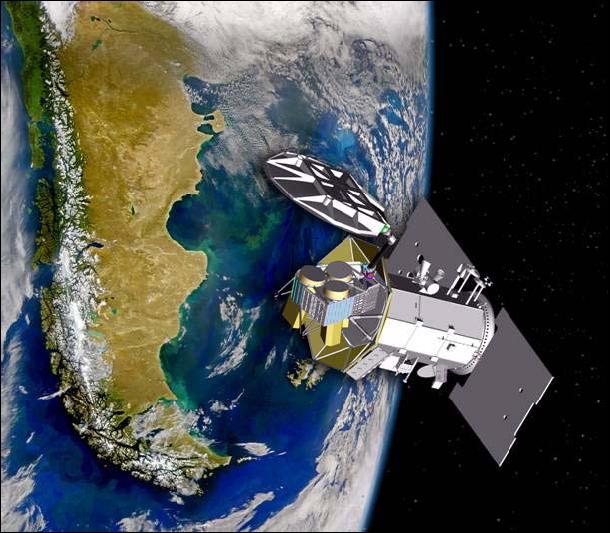
ASCAT
Advanced Scatterometer on ESA/EUMETSAT MetOp satellites

Launch: October 2006 [MetOp-A]; September 2012 [MetOp-B]
Orbit: Polar orbit at 840 km and 98.8° inclination with 29 day repeat cycle
Polarization: Linear VV
Frequency: 5.225 GHz
Pulse width: 10,000 μsec
Pulse repetition frequency: 29 Hz
Transmit power: 120 W [peak] / 34.8 W [average]
Transmit duty cycle: 29%
ASCAT is MetOp's Advanced SCATterometer. Its primary function is to provide measurements of wind velocity over the world's oceans using radar.
-
ATMS
Advanced Technology Microwave Sounder on NOAA's Suomi National Polar-orbiting Partnership (SNPP) mission
Launch: October 2011
Orbit: Sun-synchronous at 824 km and 98.74° inclination, descending node at 1030 local, with 16 day repeat cycle (8-day quasi-repeat)
Frequency: 23.8 GHz, 31.4 GHz, 50.3 GHz, 51.8-55.5 GHz (6), 57.3 GHz (6), 89 GHz, 166.3 GHz, and 183.3 GHz (6)
Microwave sounder data, and infrared sounder (CrIS) data, provide daily global atmospheric temperature, moisture, and pressure profiles. SNPP mission demonstrates the new technology to be flown on the next generation of NOAA low-altitude, polar-orbiting weather satellites.
-
COSMO-SkyMed
COnstellation of small Satellites for the Mediterranean basin Observation on Italian Space Agency (ISA) X-band SAR mission
Launch: June 2007
Orbit: Polar orbit at 620 km and 97.8° inclination with 16 day repeat
Polarization: Linear HH
Frequency: 9.6 GHz
Bandwidth: 41–118 MHz
Pulse width: 18–31 μsec
Pulse repetition frequency: 2850–3230 Hz
Transmit power: 7.6 kW [peak] / 836 W [average]
Chirp rate: 3.81 MHz/μsec
Transmit duty cycle: 7–11%
-
CPR
Cloud Profiling Radar on NASA/CSA Cloudsat
Launch: 28 April 2006
Orbit: Polar orbit at 705 km and 98.2° inclination with 16 day repeat
Polarization: Linear
Frequency: 94.05 GHz
Bandwidth: 0.37 MHz
Pulse width: 3.33 μsec
Pulse repetition frequency: 4300 Hz
Transmit power: 1 kW [peak] / 21.31 W [average]
Transmit duty cycle: 1.33%
The objective of CPR is to provide information on the vertical structure of all cloud systems.
-
ESCAT
Scatterometer on ESA Earth Remote Sensing satellites (ERS-1 and -2)
Launch: 17 July 1991 [ERS-1]; 21 April 1995 [ERS-2]
Orbit: Sun-synchronous orbit (quasi-polar) at 785 km with three possible repeat cycles: 3-day, 35-day, and 176-day [ERS-1];
Sun-synchronous polar orbit at 780 km and 98.5° inclination with repeat cycles of 3 days or 35 days [ERS-2]
Polarization: VV
Frequency: 5.3 GHz
Pulse width: 130 μsec [fore- and aft-beams]; 70 μsec [mid-beam]; 37.2 μsec [image/wave mode]
Pulse repetition frequency: 98 Hz [fore- and aft-beams]; 115 Hz [mid-beam]
Transmit power: 4 kW [peak]
Chirp rate: variable, 1.68 kHz typical [image/wave mode]
The Active Microwave Instrument (AMI, a.k.a. ESCAT) is a combination of a C-band SAR and a wind scatterometer. Its primary geophysical data products are ocean wind surface speed and direction, ocean wave length and direction, and high-resolution radar-mapping of land, ocean, ice, and coastal zones. The ERS-1 payload also included a radar altimeter, an along-track scanning infrared radiometer, a microwave sounder, and other measurement equipment.
The ERS-2 satellite is essentially a copy of ERS-1, except that it includes a number of enhancements; it is also carrying a new payload instrument to measure the chemical composition of the atmosphere, named GOME (Global Ozone Monitoring Experiment).
-
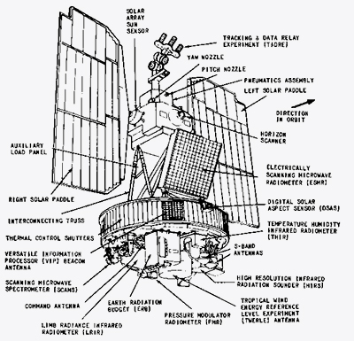
ESMR
Electrically Scanning Microwave Radiometer on NASA Nimbus-5
Launch: 11 December 1972
Orbit: Sun-synchronus at 1112 km and 81° inclination with a local noon (ascending) and midnight (descending) equator crossing
Polarization: H
Frequency: 19 GHz
The electrically scanning microwave radiometer (ESMR) was an instrument carried by the Nimbus-5 satellite, precursor to the scanning multichannel microwave radiometer (SMMR) and special sensor microwave/imager (SSM/I) instruments. However, results are difficult to compare to SMMR / SSMI. The ESMR scanned along the satellite track, leading to a wide range of incident angles; SMMR scanned with a constant angle of 50 degrees, allowing both horizontally and vertically polarized data to be received; SMMR also had 5 channels instead of one, leading to improved sea ice retrievals.
-
ESTAR
Flights: June/July 2002
Polarization: H
Frequency: 1.413 GHz
RF bandwidth: 20 MHz
The Electronically Steered Thinned Aperture Radiometer (ESTAR) was deployed during the Soil Moisture Experiment 2002 (SMEX02) for estimating surface soil moisture with an L-band radiometer. These data are not available for distribution because problems with condensation within the instrument affected performance and quality control. Processing is no longer being completed. This study was conducted during June and July 2002 in the area of the Ames, Iowa, USA.
These data were collected as part of a validation study for the Advanced Microwave Scanning Radiometer - Earth Observing System (AMSR-E). AMSR-E is a mission instrument launched aboard NASA's Aqua Satellite on 04 May 2002. AMSR-E validation studies linked to SMEX are designed to evaluate the accuracy of AMSR-E soil moisture data. Specific validation objectives include assessing and refining soil moisture algorithm performance; verifying soil moisture estimation accuracy; investigating the effects of vegetation, surface temperature, topography, and soil texture on soil moisture accuracy; and determining the regions that are useful for AMSR-E soil moisture measurements.
-
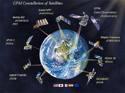
GMI
Global Precipitation Mission (GPM) Microwave Imager on NASA/JAXA mission
Projected launch: mid-2014
Orbit: Circular orbit at 407 km and 65° inclination
Frequency: 10.7 GHz, 18.7 GHz, 23.8 GHz, 36.5 GHz, 89 GHz, 165.5 GHz, and 183 GHz
GPM is devoted to determining rainfall over the Earth through the use of a precipitation radar and radiometer as well as optical instruments. Retrieves heavy, moderate , and light precipitation (rain water content) using polarization difference in each channel. Consortium includes CNES, ISRO, NOAA, and EUMETSAT.
-
JERS-1 SAR
Japan Earth Resources Satellite-1: Synthetic Aperture Radar
Launch: February 1992
Orbit: Polar orbit at 568 km and 97.7° inclination with 44 day repeat
Polarization: single: HH.
Frequency: 1275 MHz
Bandwidth: 15 MHz
Pulse width: 35 μsec
Pulse repetition frequency: 1505.8 - 1606.0 Hz
Transmit power: 1.1 - 1.5 kW [peak]
-
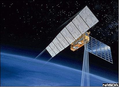
JMR/AMR
JASON/Advanced Microwave Radiometer on CNES/NASA JASON-1, -2 (OSTM)
Launch: December 2001 [J-1]; June 2008 [OSTM]
Orbit: Polar orbit at 1336 km and 66° inclination with 10 day repeat
Frequency: 18.7 GHz [sea surface winds], 23.8 GHz [water vapor], and 34 GHz [non-raining clouds]
Measures ocean surface height using a radar altimeter. OSTM is the Ocean Surface Topography Mission also known as JASON-2.
-
KOMPSAT
SAR instrument on KARI Korea Multi-Putpose Satellite [KOMPSAT-5] Earth observation mission
Launch: Late 2012
Orbit: Polar orbit at 550 km and 97.6° inclination with 28 day repeat
Frequency: 9.66 GHz
Transmit power: 2 kW [peak]
KOMPSAT-2 (also referred to as Arirang-2 by South Korea) was developed by KARI (Korea Aerospace Research Institute) to continue the observation program of the KOMPSAT-1 mission. The main mission objectives of the KOMPSAT-2 are to provide a surveillance capability for large-scale disasters by acquiring high-resolution imagery for GIS (Geographic Information Systems) applications.
-
MHS
Microwave Humidity Sounder on NOAA-KLMN
First launch: 13 May 1998
Orbit: Sun-synchronous at 833 km
Frequency: 89 GHz, 157 GHz, 183.3 GHz (2), 190.3 GHz
NOAA-K, -L, -M, and -N are a series of low Earth orbiting meteorological satellites. Observations are sensitive to humidity and also to (a) liquid water in clouds (cloud liquid water content) and (b) graupel and large water droplets in precipitating clouds (qualitative estimate of precipitation rate)
-
MicroWave Radiometer
Argentina's MicroWave Radiometer on SAC-D Satellite
Launch: June 2011
Orbit: Polar orbit at 657 km and 98° inclination with 7 day repeat
Polarization: Linear H and V
Frequency: 23.8 GHz and 36.5 GHz
1.4 GHz radiometer measurements are complemented by MicroWave Radiometer (MWR) measuring winds, rainfall, water vapor, and sea ice.
-
MIRAS
Microwave Imaging Radiometer using Aperture Synthesis on ESA Soil Moisture Ocean Salinity Mission (SMOS)
Launch: November 2009
Orbit:Sun-synchronous dawn/dusk quasi-circular orbit at 758 km
Polarization: H, V
Frequency: 1.4–1.427 GHz
Moisture and salinity decrease the emissivity of soil and seawater respectively, and thereby affect microwave radiation emitted from the surface of the Earth. L-band provides the maximum sensitivity of the emissivity to both SM (Soil Moisture) and OS (Ocean Salinity).
The overall objective of MIRAS is to provide records of pixel brightness temperatures over incidence angles from 0º up to 55º across a 900 km swath, with a spatial resolution in the range of 30-50 km. From these profiles and auxiliary information, like surface physical temperature, roughness and ionospheric total electron content among others, soil moisture and sea surface salinity will be retrieved.
-
MTVZA-GY
Microwave Imaging/Sounding Radiometer on Russian METEOR-M and M1 meterological satellite series
First launch: 17 September 2009
Orbit: Polar orbit at 820 km
Frequency: 10.6 GHz, 18.7 GHz, 23.8 GHz, 31.5 GHz, 36.5 GHz, 42 GHz, 48 GHz, 52.8 GHz, 55 GHz, 57 GHz, 91.65 GHz, 92 GHz, and 183 GHz
Monitors ocean and land surfaces as well as global atmospheric temperature and water vapor profiles, and obtains sea surface wind profiles. Provide low resolution temporal/high resolution spatial sounding of the temperature and water profiles in the atmosphere.
-
MWHS
MicroWave Humidity Sounder on Chinese FY-3 (FengYun-3) weather satellite series
First launch: 27 May 2008
Orbit: Sun-synchronous at 836.4 km, descending node FY-3a 1010, FY-3b 1330 local time
Frequency: 150 GHz, 183.3 GHz
Observes the atmospheric humidity profile, water vapor, rainfall, cloud liquid water, etc. Measures humidity (water) profile of the atmosphere with low temporal resolution and high spatial resolution.
-
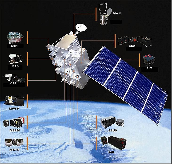
MWRI
MicroWave Radiation Imager on Chinese FY-3 (FengYun-3) weather satellite series
First launch: 27 May 2008
Orbit: Sun-synchronous at 836.4 km, descending node FY-3a 1010, FY-3b 1330 local time
Frequency: 10.65 GHz, 18.7 GHz, 23.8 GHz, 36.5 GHz, 89 GHz, and 150 GHz
Observes rainfall, soil moisture, cloud liquid water, sea surface parameters. Measures atmospheric and surface water with low temporal resolution and high spatial resolution.
-
MWTS
MicroWave Temperature Sounder on Chinese FY-3 (FengYun-3) weather satellite series
Launch: 27 May 2008
Orbit: Sun-synchronous at 836.4 km, descending node FY-3a 1010, FY-3b 1330 local time
Frequency: 50.3 GHz, 53.6 GHz, 55 GHz, and 57 GHz
Provides atmospheric temperature profile, rainfall, cloud liquid water, surface parameters, etc. Measures temperature profile of the atmosphere with low temporal resolution and high spatial resolution.
-
NSCAT
NASA Scatterometer on JAXA (Japanese) Advanced Earth Observing Satellite (ADEOS, a.k.a. Midori)
Launch: 17 August 1996
Orbit: Sun-synchronous sub-recurrent polar orbit at 789–805 km and 98.625° inclination with 41 day repeat cycle (3 day subcycle)
Polarization: 6 V, 2 H
Frequency: 13.995 GHz
Pulse width: 5 ms
Pulse repetition frequency: 62 Hz
Transmit power: 110 W [peak]
Transmit duty cycle: 100%
NSCAT is a NASA/JPL fan-beam Doppler scatterometer. Objective: Measurement of surface wind speeds and directions over the global oceans, coverage every two days under all weather and cloud conditions, using an array of six antennas that radiate microwave pulses across broad regions of the Earth's surface. NSCAT is an upgraded version of the Radar Scatterometer (SASS) on SeaSat.
-
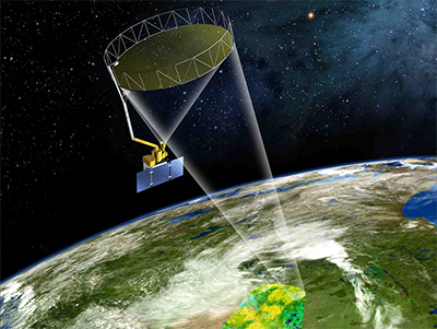
OSCAT
Scatterometer on ISRO (India) Oceansat-2 mission
Launch: September 2009
Orbit: near polar sun-synchronous orbit at 720 km and 98.28° inclination with a 2 day repeat
Polarization: Linear HH, VV
Frequency: 13.5156 GHz
RF bandwidth: 0.4 MHz
Pulse width: 1,350 μsec
Pulse repetition frequency: 200 Hz
Transmit duty cycle: 100%
Antenna diameter: 1 m
Ku-band pencil beam scatterometer for oceanographic measurements. Second in a series of ISRO oceanographic research satellites.
-
PALS
Passive Active L- and S-band combined polarimetric radiometer and NASA licensed radar, flown on the NASA P-3 (below) and other aircraft
Flights: 1999–2009
Altitude: 1.15 km
Polarization: H, V [radiometer]; HH, VV, HV, VH [radar]
Frequency: 1.41/2.69 GHz [radiometer]; 1.26/3.15 GHz [radar]
PALS was designed and built to investigate the benefits of combining passive and active microwave sensors for Ocean salinity and Soil moisture remote sensing. It is the prototype for the Aquarius and SMAP missions and its flexible design is compatible with many aircraft. It has flown on the NCAR C-130, NASA’s P-3 and Twin Otter International’s, Twin Otter. It is a very mature instrument, and has flown more than 800 hours, in support of NASA campaigns.
-
PiSAR
NICT (Japanese) airborne L-band Polarimetric and Interferometric SAR

Flights: 1993–present [PiSAR and PiSAR2]
Altitude: 12 km
Polarization: HH, VV, HV
Frequency: 9.55 GHz
RF bandwidth: 100 MHz [PiSAR]; 500/300/150 MHz [PiSAR2]
Transmit power: 7.5 kW [peak H]; 7.0 [peak V]
The effectiveness of Pi-SAR has been demonstrated by covering actual volcanic eruption and earthquake disaster sites. Using this equipment, areas of over 10 km wide, flying distances of over 50 km can be observed in a single pass from an altitude of 12,000 m. The main benefit of SAR imagery is the fact that the observations are not obstructed by cloud or rain, and can be made during the night. The development of Pi-SAR2 was started in 2006 to achieve higher performance for practical application during disasters with sub-meter spatial resolution.
-
PolSCAT
Airborne Ku-band polarimetric scanning scatterometer with an approved NASA license, flown on the C-130 (below), and other aircraft
Flights: 1999–2010
Polarization: HH, VV, HV, VH
Frequency: 13.95 GHz
PolSCAT’s flexible design is compatible with many aircraft. It has flown on the NCAR C-130, NASA’s DC-8, P-3, and Twin Otter International’s, Twin Otter. Having flown more than 500 hours in support of NASA’s Cold Land Process (CLPX) campaigns, PolSCAT is a very mature instrument.
-
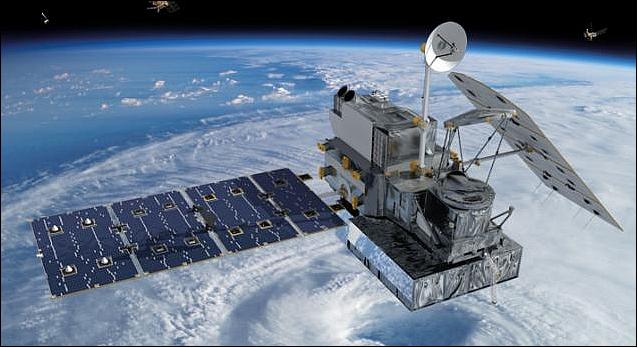
Precipitation Radar on GPM
Global Precipitation Mission (GPM) dual frequency precipitation instrument on NASA/JAXA mission (follow-up to TRMM)
Projected launch: mid-2014
Orbit: Circular orbit at 407 km and 65° inclination
Frequency: 13.6 GHz amd 35.56 GHz
Bandwidth: 14 MHz
Pulse width: 1.6 μsec
Pulse repetition frequency: 4206 Hz [Ku-band]; 4275 Hz [Ka-band]
Transmit power: 1 kW (peak) / 140 W (average) [Ku-band]; 6.7 W (peak) / 0.94 W (average) [Ka-band]
Chirp rate: 8.75 MHz/μsec
Transmit duty cycle: 0.67%
GPM concept centers on the deployment of a “Core” satellite carrying an advanced radar / radiometer system to measure precipitation from space and serve as a reference standard.
-
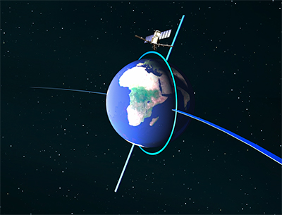
Radar Altimeter on SWOT
Ka-band altimeter on NASA/CNES Surface Water and Ocean Topography (SWOT) mission
Projected launch: 2020
Orbit: Orbit at 970 km and 78° inclination with 22 day repeat
Polarization: Dual
Frequency: 35.6 GHz
Bandwidth: 200 MHz
Pulse width: 5.1 μsec
Pulse repetition frequency: 4400 Hz
Transmit power: 1.5 kW [peak] / 33.66 W [average]
Chirp rate: 39.22 MHz/μsec
Transmit duty cycle: 2.24%
-
RISAT
SAR on ISRO (India) Radar Satellite-1 (RISAT-1)
Launch: April 2012
Orbit: Polar orbit at 536 km and 97° inclination
Frequency: 5.35 GHz
RF bandwidth: 18.75–75 MHz
Transmit power: 4 kW [peak]
Chirp rate: 0.937–3.75 MHz/μsec
Radar Satellite-1 (RISAT-1) carries a SAR Payload operating in C-band which enables imaging of the surface features.
-
SAR on Radarsat-1 and -2
Canadian (CSA) satellites using C-band SARs
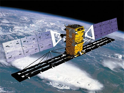
Launch: November 1995 [R-1]; December 2007 [R-2]
Orbit: Polar orbit at 798 km and 98.6° inclination with 24 day repeat
Polarization: Linear HH, VV, HV, VH
Frequency: 5.405 GHz
Bandwidth: 11.6–100 MHz
Pulse width: 21 μsec, 42 μsec
Pulse repetition frequency: 1000–3800 Hz
Transmit power: 5 kW [peak] / 798 W [average]
Chirp rate: 2.38 MHz/μsec
Transmit duty cycle: 15.96%
-
SASS
SeaSat-A Scatterometer System on NASA SeaSat
Launch: 26 June 1978
Orbit: Non-sun-synchronous near circular polar orbit, at 775–799 km and 108° inclination with repeat cycle of 17 days (subcycle of 3 days)
Polarization: V-H, V-H
Frequency: 14.599 GHz
Transmit power: 100 W [peak]
Transmit duty cycle: Variable
SeaSat (also referred to as SeaSat-A prior to launch and SeaSat-1 after launch) is a pioneering Earth observation experimental mission of NASA/JPL; the first ever civilian spaceborne imaging radar instrument (SAR) was flown on SeaSat in 1978. During its brief 110-day lifetime (end of mission due to a malfunction), SeaSat collected more information about the oceans than had been acquired in the previous 100 years of shipboard research.
SASS was a proof-of-concept experiment for measuring ocean surface wind vectors under day/night near-all-weather conditions. The physical basis for this remote sensing technique is the generation of capillary waves on the ocean surface by the friction velocity of the wind.
-
SCAMS
Scanning Microwave Spectrometer on NASA Nimbus-6
Launch: 12 June 1975
Orbit: Polar orbit at 1093–1101 km and 100° inclination
Frequency: 22.235 GHz, 31.65 GHz, 52.85 GHz, 53.85 GHz, and 55.45 GHz
The Nimbus 6 Scanning Microwave Spectrometer (SCAMS) was designed to map tropospheric temperature profiles, water vapor abundance, and cloud water content to be used for weather prediction even in the presence of clouds, which block conventional satellite infrared sensors.
-
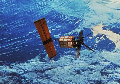
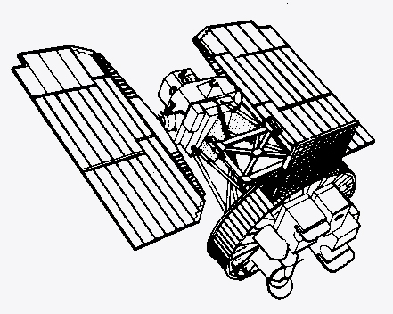
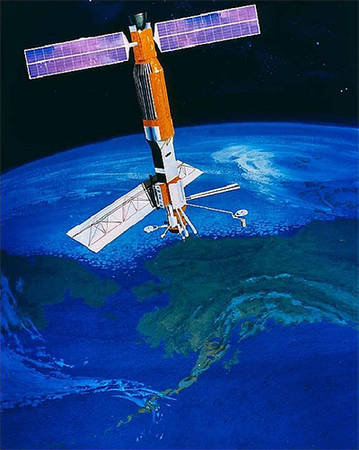
SeaSat
NASA Seafaring Satellite: Synthetic Aperture Radar
Launch: June 1978
Orbit: Polar orbit at 785 km and 108° inclination with 17 day repeat
Polarization: single: HH.
Frequency: 1275 MHz
Bandwidth: 19 MHz
Pulse width: 33.4 μsec
Pulse repetition frequency: 1464 to 1640 Hz
Transmit power: 1 kW [peak]
Transmit duty cycle: 10%
Seasat was the first satellite designed for remote sensing of the Earth's oceans with synthetic aperture radar (SAR). The mission was designed to demonstrate the feasibility of global satellite monitoring of oceanographic phenomena and to help determine the requirements for an operational ocean remote sensing satellite system. Specific objectives were to collect data on sea-surface winds, sea-surface temperatures, wave heights, internal waves, atmospheric water, sea ice features and ocean topography. The mission ended on October 10, 1978 due to a failure of the vehicle's electric power system. Although only approximately 42 hours of real time data was received, the mission demonstrated the feasiblity of using microwave sensors to monitor ocean conditions, and laid the groundwork for future SAR missions.
-
SeaWinds
Scatterometer (NSCAT-II) on NASA QuickSCAT satellite
Launch: 19 June 1999
Orbit: Circular sun-synchronous polar orbit at 803 km and 98.6° inclination with a local equator crossing time on the ascending node of 6:00 hours ± 30 minutes
Polarization: H, V
Frequency: 13.4 GHz
Pulse repetition frequency: 189 Hz
Transmit power: 110 W
Transmit duty cycle: 100%
Antenna diameter: 1 m
-
SIR-C/X-SAR
Shuttle Imaging Radar with Payload C / X-SAR, a cooperative NASA/JPL, DARA/DLR, and ASI (Agenzia Spaziale Italiana) project flown on Space Shuttle Endeavour
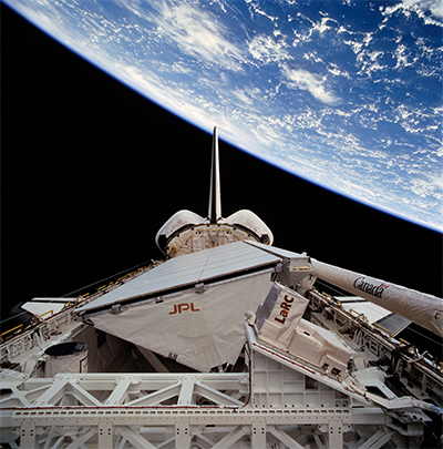
Launch: 9 April 1995 [STS-59 mission]; 30 September 1994 [STS-68 mission]
Orbit: Shuttle circular orbit at 225 km and 57° inclination
Polarization: HH, VV, HV, VH [L-band and C-band]; VV [X-band]
Frequency: 1.250 GHz, 5.3 GHz, and 9.6 GHz
Pulse width: 33.17 or 8.5 μsec [L-band and C-band]; 40 μsec [X-band]
Pulse repetition frequency: 1395–1736 Hz
Transmit power: 4.4 kW [L-band]; 1.2 kW [C-band]; 1.4 kW [X-band]
Objectives include conducting geoscience investigations that require the observational capabilities of orbiting radar sensors, alone or in conjunction with other sensors, that will lead to a better understanding of the surface conditions and processes on the Earth; Exploring regions of the Earth's surface that are not well characterized because of vegetation, cloud, or sediment cover in order to better understand land and ocean surface conditions and processes on a global scale; and incorporating this new knowledge into global models of surface and subsurface processes.
-
SIRAL
SAR Interferometer Radar Altimeter on ESA CryoSat
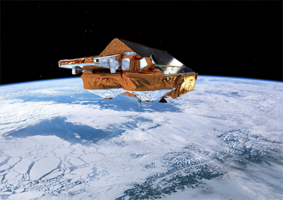
Launch: 8 October 2005
Orbit: Non sun-synchronous circular LEO orbit at 717 km and 92° inclination with 369 day ground track repeat cycle (30 day pseudo subcycles).
Polarization:
Frequency: 13.575 GHz
RF bandwidth: 320 MHz
Pulse width: 50 μsec
Pulse repetition frequency: 1.97 kHz [LRM]; 17.8 kHz [SAR and SARIn]
Transmit power: 25 W [peak]
Antenna size: 2 reflectors each 1.2 × 1.1 m
CryoSat is the first Earth Explorer Opportunity Mission in ESA's Living Planet Program; it is a next-generation radar altimetry mission dedicated to observations of the polar regions. The science objectives are to determine variations in the thickness of Arctic sea ice and elevation changes of ice sheets, ice caps and glaciers that ring the Arctic Ocean (continental ice sheets).
-
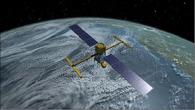
SMAP
L-band Scatterometer on NASA Soil Moisture Active Passive (SMAP) mission
Projected Launch:
Orbit: Polar orbit at 670 km and 98° inclination with 3 day repeat
Polarization: Dual, Linear H & V
Frequency: 1215-1300 MHz
RF bandwidth: 1 MHz
Pulse width: 15 μsec
Pulse repetition frequency: 3500 Hz
Transmit power: 200 W [Peak] / 28 W [Average]
Chirp rate: 0.067 MHz/μsec
Transmit duty cycle: 5.25%
Antenna diameter: 6 m
SMAP will utilize a frequency hopping scheme to mitigate interference to/from terrestrial radars operating in this band.
-
SMMR (SeaSat)
;
SMMR (Nimbus-7)
Scanning Multichannel Microwave Radiometer on NASA/JPL SeaSat and Nimbus-7 Satellites
Launch: 26 June 1978 [SeaSat]; 24 October 1994 [Nimbus-7]
Orbit: Non-sun-synchronous near circular polar orbit, at 775–799 km and 108° inclination with repeat cycle of 17 days (subcycle of 3 days) [SeaSat];
Sun-synchronous polar orbit at 941–954 km and 99.15° inclination with local equator crossing time on the ascending node at 12:00 hours (and midnight descending) [Nimbus-7]Polarization: H, V
Frequency: 6.6 GHz, 10.69 GHz, 18 GHz, 21 GHz, and 37 GHz
SeaSat (also referred to as SeaSat-A prior to launch and SeaSat-1 after launch) is a pioneering Earth observation experimental mission of NASA/JPL; the first ever civilian spaceborne imaging radar instrument (SAR) was flown on SeaSat in 1978. During its brief 110-day lifetime (end of mission due to a malfunction), SeaSat collected more information about the oceans than had been acquired in the previous 100 years of shipboard research.
The SMMR is a five-frequency instrument designed and built at JPL. Objectives: Monitoring sea surface temperatures, wind speeds, rain rate, atmospheric water content (mapping of columnar water vapor distribution over the global oceans) and ice conditions
Nimbus is a NASA meteorological research-and-development satellite program (parallel to the operational TIROS program) which started in 1963 with the prime objective to test new instrument concepts (introduction of sensor technology), a secondary objective was to provide atmospheric data for improved weather forecasts.
-
SSALT
Sea Surface Altimeter on NASA/CNES JASON-1, -2 (OSTM)
Launch: December 2001 [J-1]; June 2008 [OSTM]
Orbit: Polar orbit at 1336 km and 66° inclination with 10 day repeat
Polarization: Linear
Frequency: 5.3 GHz and 13.575 GHz
Bandwidth: 100/320 MHz [C-bnad]; 320 MHz [Ku-band]
Pulse width: 105.6 μsec
Pulse repetition frequency: 1890–2310 Hz
Transmit power: 16 W, 7 W [peak] / 3.9 W, 1.7 W [average]
Chirp rate: 0.9 MHz/μsec, 3.0 MHz/μsec
Transmit duty cycle: 24.4%
This mission obtains measurements of ocean surface height using radar altimeter. OSTM is the Ocean Surface Topography Mission also known as JASON-2.
-
SSM/I
Special Sensor Microwave Imager on Defense Meteorological Satellite Program (DMSP)
First launch: 12 December 1999
Orbits: Sun-synchronous orbits at 811 - 853 km, normally two in operation at any time (one morning and one late morning equatorial crossing time)
Frequency: 19.35 GHz (2), 22.24 GHz, 37 GHz (2), 85 GHz (2)
Provides low-resolution-temporal/high-resolution-spatial sounding of the atmosphere and surface. Measures sea surface winds, rain rates, cloud water, precipitation, soil moisture, ice edge, and ice chronological age.
-
TanDEM-X
TerraSAR-X add-on for Digital Elevation Measurement
Launch: 21 June 2010
Orbit: Polar orbit at 514 km and 97.4° inclination with 11 day repeat
Polarization: Linear VV
Frequency: 9.65 GHz
Bandwidth: 150 MHz, 300 MHz
Pulse width: 47 μsec
Pulse repetition frequency: 2000–6500 Hz
Transmit power: 2 kW [peak] / 400 W [average]
Chirp rate: 3.2 MHz/μsec, 6.8 MHz/μsec
Transmit duty cycle: 20%
This mission flies near TerraSAR-X to perform interferometric SAR (InSAR) observations.
-
TecSAR
X-band SAR ISA (Israel) Technology Demonstration Mission
Launch: January 2008
Orbit: Orbit at 450-580 km and 41° inclination
Polarization: Linear VV
Frequency: 9.6 GHz
Bandwidth: 200 MHz
TecSAR is the first spaceborne radar minisatellite technology demonstration mission of Israel's MoD (Ministry of Defense), designed and developed by IAI/MBT (Israel Aerospace Industries Ltd.) formerly known as Israel Aircraft Industries Ltd., a government owned company. The prime objective is to provide high-resolution SAR imagery, day and night, in all weather conditions, at an affordable cost.
-
TerraSAR-X
X-band SAR on DLR (German) TerraSAR-X active sensing mission
Launch: June 2007
Orbit: Polar orbit at 514 km and 97.4° inclination with 11 day repeat
Polarization: Linear VV
Frequency: 9.65 GHz
Bandwidth: 150 MHz, 300 MHz
Pulse width: 47 μsec
Pulse repetition frequency: 2000–6500 Hz
Transmit power: 2 kW [peak] / 400 W [average]
Chirp rate: 3.2 MHz/μsec, 6.8 MHz/μsec
Transmit duty cycle: 20%
This mission employs an active phased array antenna SAR with ~1 m resolution capability.
-
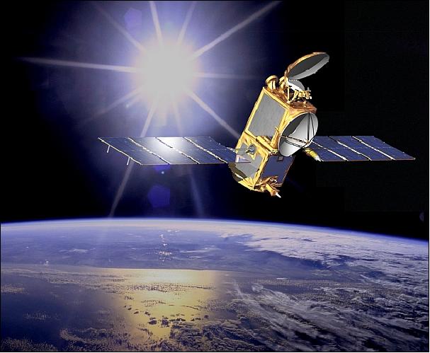
TMI
TRMM Microwave Imager on NASA/JAXA Joint Tropical Rainfall Measurement Mission (TRMM)
Launch: November 1997
Orbit: Circular orbit at 350 km and 35° inclination with 23 day repeat; Equatorial orbit to observe topics and subtropics only.
Frequency: 10.7 Ghz, 19.4 Ghz, 21.3 Ghz. 37 Ghz, and 85.5 Ghz
Determines rainfall in the tropics and subtropics by using a precipitation radar and microwave radiometer as well as optical instruments.
-
TRMM-PR
Precipitation Radar on NASA/JAXA Joint Tropical Rainfall Measurement Mission (TRMM)
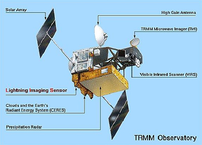
Launch: November 1997
Orbit: Circular orbit at 350 km and 35° inclination with 23 day repeat; Equatorial orbit to observe topics and subtropics only.
Polarization: Linear H
Frequency: 13.796 GHz, 13.802 GHz
RF bandwidth: 0.60 MHz
Pulse width: 2 × 1.60 μsec
Pulse repetition frequency: 2.776 kHz
Transmit power: 578 W [peak] / 2.57 W [average]
Transmit duty cycle: 0.44%
TRMM is devoted to determining rainfall in the tropics and subtropics of the Earth through the use of a precipitation radar and radiometer as well as optical instruments.
-
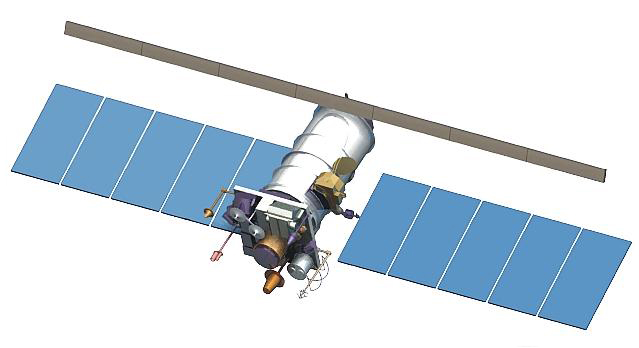
UAVSAR
NASA L-band Airborne SAR

Start date: January 2007
Altitude: 2–18 km
Polarization: HH, VV, HV, VH
Frequency: 1.2575 GHz
Pulse width: 4150 μsec
Pulse repetition frequency: 350–855 Hz
Transmit power: 1.6 kW [peak] / 70.4 W [average]
Chirp rate: 2–15 MHz/μsec
Transmit duty cycle: 0.1–4.4%
The purpose of this mission is to develop a miniaturized polarimetric L-band synthetic aperture radar (SAR) for use on an unmanned aerial vehicle (UAV) or minimally piloted vehicle. Flies periodically over US and Arctic areas.
-
WindSat
WindSat Radiometer on NASA/NRL/NOAA Coriolis Satellite
Launch: 6 January 2003
Orbit: Sunsynchronous orbit at 840 km, local time of ascending node is 1800
Frequency: 6.8 GHz, 10.7 GHz, 18.7 GHz, 23.8 GHz, and 37 GHz
Operational verification of spaceborne multichannel polarimetric radiometry as a means to measure the ocean surface wind vector (speed and direction)